Subject: Central South America, Paraguay
Period: 1733 (dated)
Publication:
Color: Hand Color
Size:
11.4 x 11.6 inches
29 x 29.5 cm
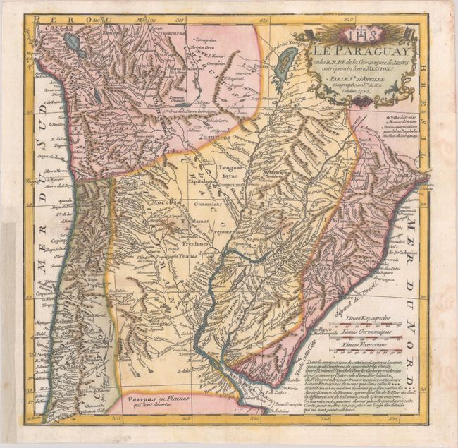
This attractive and detailed map of the central part of South America shows Jesuit missions as well as topography, rivers, and towns. The map extends from Lake Titicaca to Sao Paulo, and to Chile and the mouth of the La Plata. The La Plata is mapped with much detail, but incorrectly with its source in the mythical Laguna de Los Xareyes. The map is based on the cartography of D'Anville in 1733 and was first published a year later in a Jesuit report titled Lettres Edifiantes et Curiuses Ecrites des Missions Etrangers. Most examples on the market come from the later edition of Lettres Edifiantes et Curieuses (ca. 1781); this example, without pagination, was issued in an unidentified publication.
References:
Condition: A
A dark impression issued folding, now flat, on watermarked paper with a few light spots along the horizontal fold A binding trim in the bottom left blank margin has been replaced with old paper.