Subject: Guyana, Suriname, French Guiana
Period: 1653 (circa)
Publication: Nuevo Atlas
Color: Black & White
Size:
19.2 x 14.7 inches
48.8 x 37.3 cm
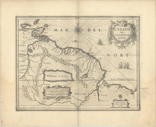
This striking map of Guiana covers the coastline from the Isla Margarita in the northwest to the coast of northern Brazil near Sao Luis east of the Amazon delta. At center lies a large inland sea, Parime Lacus; on its northwestern shore is the fabled city Manoa del Dorado, or the golden city of the Incas. The search for this city led many explorers, including Sir Walter Raleigh, on wild adventures through the jungles. The map is beautifully decorated with three cartouches, ships engaged in a sea battle, a sea monster, and a fine compass rose. Spanish text on verso, published between 1653-66.
References: Van der Krogt (Vol. I) #9840:1.2.
Condition: B
A dark impression with faint dampstaining in the lower third of the image and some light manuscript notations at lower right. A short centerfold separation confined to the bottom blank margin has been closed on verso with archival tape.