Subject: Lesser Antilles
Period: 1780 (circa)
Publication: Atlas de Toutes les Parties Connues du Globe Terrestre
Color: Hand Color
Size:
8.4 x 12.8 inches
21.3 x 32.5 cm
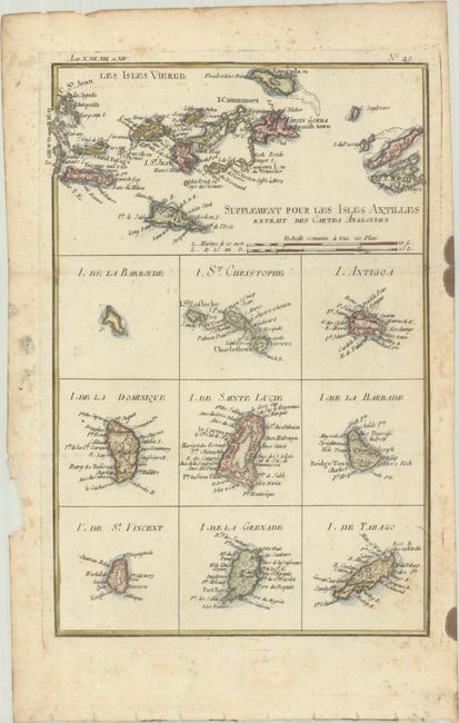
At the top of this attractive sheet there is a map of the Virgin Islands, and below that there are nine small maps of Barbuda, Saint Kitts, Antigua, Dominica, Saint Lucia, Barbados, Saint Vincent, Grenada, and Tobago. All islands are shown with a nice amount of detail despite their small size.
Rigobert Bonne was an important French cartographer of the late 18th century. In 1773 he succeeded Jacques Bellin as the royal cartographer in the office of the Hydrographer at the Depot de la Marine. Working in his official capacity, Bonne compiled some of the most detailed and accurate maps of the period.
References:
Condition: B+
A crisp impression, issued folding on a bright sheet with a "CB" watermark and light foxing that is mostly confined to the edges of the sheet. There is a chip in the left blank margin and ink stain in the right blank margin.