Subject: Caribbean
Period: 1842 (dated)
Publication:
Color: Black & White
Size:
35.1 x 24.8 inches
89.2 x 63 cm
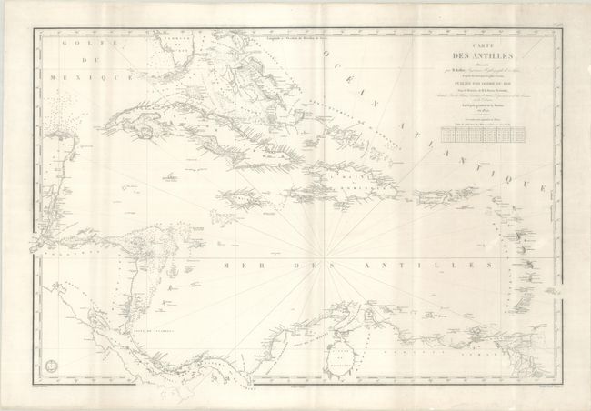
This wall-sized map of the Caribbean includes the southern tip of Florida, Central America, and northern South America. It is filled with depth soundings, safe anchorages, rocks and shoals in the sea. Towns, rivers, points, and other place names are noted along the coasts, but the inland interiors are left blank. Prepared by M. Keller under the direction of M. le Baron Duperre. Drawn by J. M. Hacq. and engraved by Chassant. The engraved seal of the Depot de la Marine is at bottom left, and the price, "Prix Deux Francs," is at bottom right.
References:
Condition: B+
A bright sheet with a "D J" watermark that has been professionally backed in archival tissue. There are vertical stripes of light soiling.