Subject: Caribbean
Period: 1769 (circa)
Publication: Hedendaagsche Historie, of Tegenwordige Staat van Amerika
Color: Hand Color
Size:
18.2 x 13.9 inches
46.2 x 35.3 cm
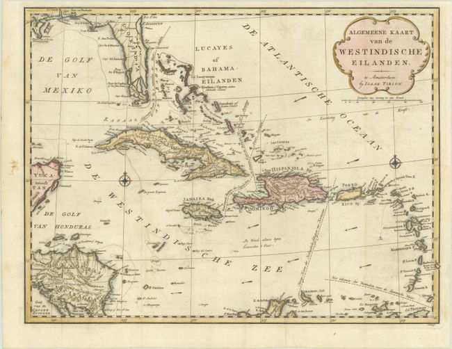
A fine, interesting chart of the Caribbean, also showing part of Florida, the Yucatan, and Central America. Even small islands are well-represented and navigational hazards are marked. Major sea routes are noted as well as the direction of the prevailing winds. Title cartouche and two compass roses decorate the chart. Engraved by J. Condet.
References: Shirley (BL Atlases) G.TIR-1a #19.
Condition: A
A dark impression, issued folding on a bright sheet with very light offsetting and a vertical printer's crease in the center of the map. A binding trim at right has been replaced with period-correct paper, and an adjacent binding tear that just enters the map border has been professionally repaired.