Subject: Caribbean & Bermuda
Period: 1740 (circa)
Publication:
Color: Hand Color
Size:
22.3 x 19.5 inches
56.6 x 49.5 cm
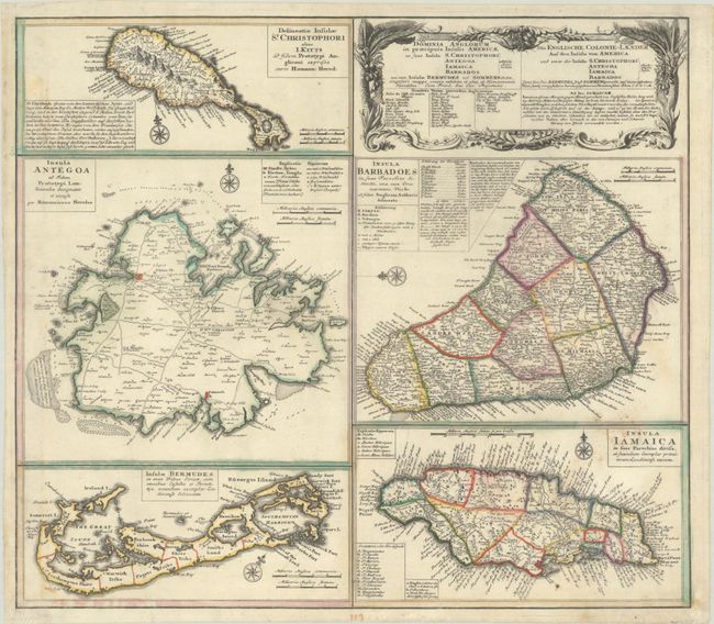
A large and striking sheet that contains five charts describing the islands of St. Kitts, Antigua, Bermuda, Barbados, and Jamaica. All of these maps were copied from separate maps made by Herman Moll in 1729. Each is finely engraved and meticulously detailed with its own compass rose, soundings, roads, forts, churches, topography, and political divisions, as well as descriptive text and place name keys. The map has a second title in German: Die Englische Colonie-Laender auf den Insuln von America. This is the second state with Bermuda named "Bermudes."
References: Evans (Bermuda) Homann's Heirs [1737]; cf. Sellers & Van Ee #1723.
Condition: B+
A sharp impression with contemporary outline color on a bright sheet with the heart-shaped watermark of Sebastian Heerdegen. There are some light dampstains and a few mildew spots around the title cartouche of the map of Jamaica.