Subject: Gulf of Mexico & Caribbean
Period: 1788 (circa)
Publication:
Color: Hand Color
Size:
45.3 x 20 inches
115.1 x 50.8 cm
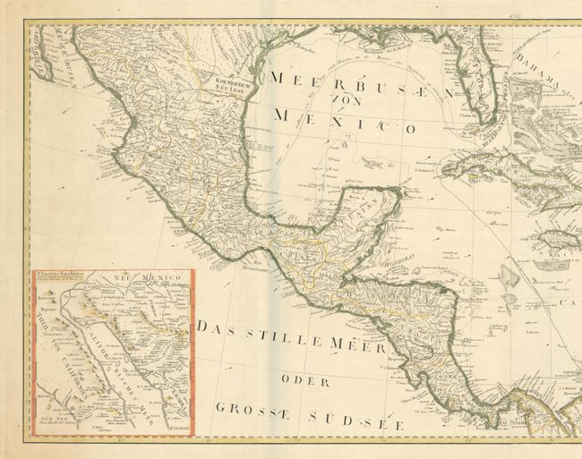
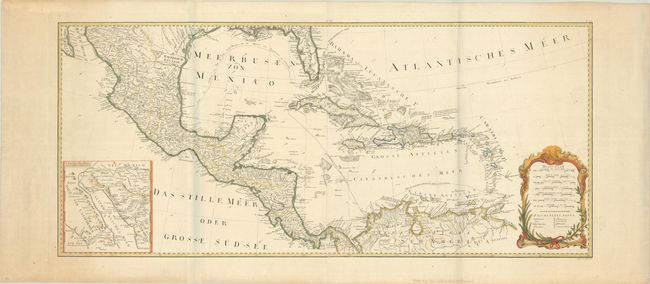
This is the southern half of the four-sheet map of North America (missing the two sheets depicting the United States). It features excellent detail of towns, political boundaries, roads, rivers, mines, and more. The routes of the Spanish galleons heading to Havana, Cartagena and Mexico are shown. The map is a German-language edition of Emmanuel Bowen and John Gibson's An Accurate Map of North America Describing and Distinguishing the British, Spanish and French Dominions on this Great Continent…, which was first published in 1763 to illustrate the seat of the French and Indian War. The map is adorned with a rococo cartouche containing distance scales and a legend. Engraved by Johann Stenger. Two sheets, joined.
References: Phillips (Atlases) #694.
Condition: A
Nice impressions on bright, watermarked sheets with a few minor spots, a couple of tiny worm holes, and light toning at far right and left. The grayish shadows along the folds are caused by our scanner and do not appear on the map itself.