Subject: Gulf of Mexico & Caribbean
Period: 1780 (circa)
Publication: Atlas de Toutes les Parties Connues du Globe Terrestre
Color: Hand Color
Size:
12.6 x 8.3 inches
32 x 21.1 cm
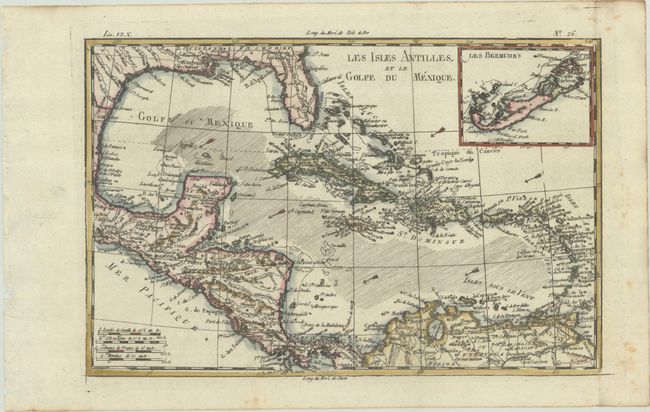
A beautiful and strongly engraved chart of the Caribbean that also features good detail of Central America. Along the Gulf Coast and Florida, New Orleans, Pensacola, and St. Augustine are named. Navigation routes, trade winds, rocks, and shoals are identified. An inset of Bermuda is located at upper right.
Rigobert Bonne was an important French cartographer of the late 18th century. In 1773 he succeeded Jacques Bellin as the royal cartographer in the office of the Hydrographer at the Depot de la Marine. Working in his official capacity, Bonne compiled some of the most detailed and accurate maps of the period.
References: Sellers & Van Ee #1705.
Condition: A
A dark impression, issued folding on a bright sheet with a "CB" watermark, binding holes along the left edge of the sheet, and a few spots of foxing along the edges of the sheet.