Subject: Gulf of Mexico & Caribbean
Period: 1740 (dated)
Publication:
Color: Hand Color
Size:
19.2 x 22.8 inches
48.8 x 57.9 cm
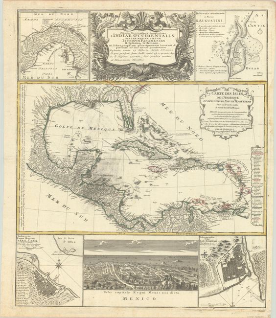
This informative and very graphic folio sheet has a large map of the region, titled Carte des Isles de l'Amerique et Deplusieurs Pays de Terre Ferme, attributed to D'Anville (1731). The map covers the Gulf of Mexico, Central America, and all of the Caribbean islands. It is nicely detailed with a key to show European possessions and a beautifully engraved title cartouche. Above the main map is the large, decorative title cartouche, flanked by insets of the isthmus of Panama and a plan of St. Augustine in Florida. Below the map is a large view of Mexico City, flanked by plans of Vera Cruz and San Domingo. A very handsome sheet, absolutely filled with information on the West Indies.
References:
Condition: B+
Contemporary outline color on a watermarked sheet. There is some printer's ink residue at center and scattered foxing along the sheet edges. A narrow dampstain and two tiny repaired tears are confined to the right side margin.