Subject: Southwestern United States & Mexico
Period: 1811 (published)
Publication:
Color: Black & White
Size:
5.3 x 8.3 inches
13.5 x 21.1 cm
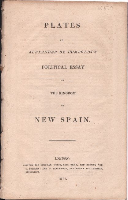
This is the atlas volume to accompany the London editions of Humboldt's Political Essay. There are a total of 9 illustrations consisting of four maps, three cross-sections, and two plates. Disbound. The maps included in the volume are:
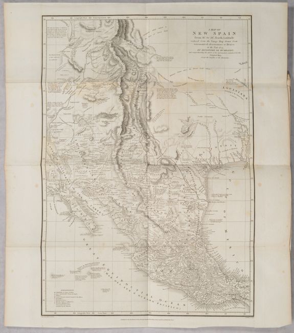
A Map of New Spain (16 x 11.2"). This is a reduced version of Humboldt's landmark map of the Southwest. The large map was the most important and accurate map of the region to be published at the time, and would remain the standard source until Fremont's mapping of the area in the 1840s. As a testament to the accuracy of the map, contemporaries Zebulon Pike and Aaron Arrowsmith copied copious information in Humboldt's map for their own publications in 1810, one year prior to Humboldt's printed map was released to the public.
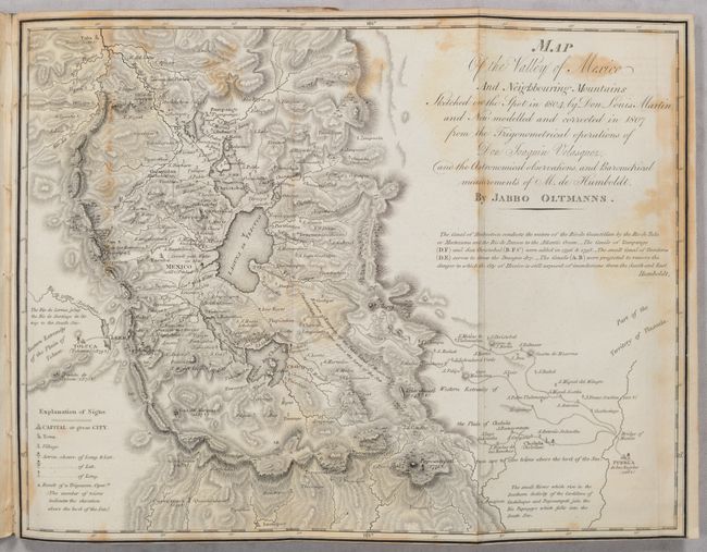
Map of the Valley of Mexico and Neighboring Mountains... (10.3 x 8.0"). A highly detailed map of the region with Mexico City at center. Shows the dramatic topography of the region through the use of dense hachuring, a technique that Humboldt developed.
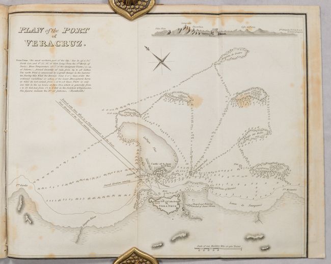
Plan of the Port of Veracruz (9.7 x 7.9"). Depicts the fortified city of Vera Cruz with the Castle of S. Juan de Ulna to its northeast. Filled with numerous soundings and useful navigational notations.
Plan of the Port of Acapulco (4.6 x 7.6"). A single-page map showing the vicinity around Acapulco. There is good coastal detail and numerous soundings in the port.
References: Wheat (TMW) #303; cf. Howes #H-786; cf. Sabin #33715.
Condition: B
Contents are good with light to moderate scattered foxing. The map of New Spain is the nicest plate in the set with minimal foxing and offsetting (B+). Disbound.