Subject: Washington
Period: 1947 (dated)
Publication:
Color: Printed Color
Size:
32.7 x 21.2 inches
83.1 x 53.8 cm
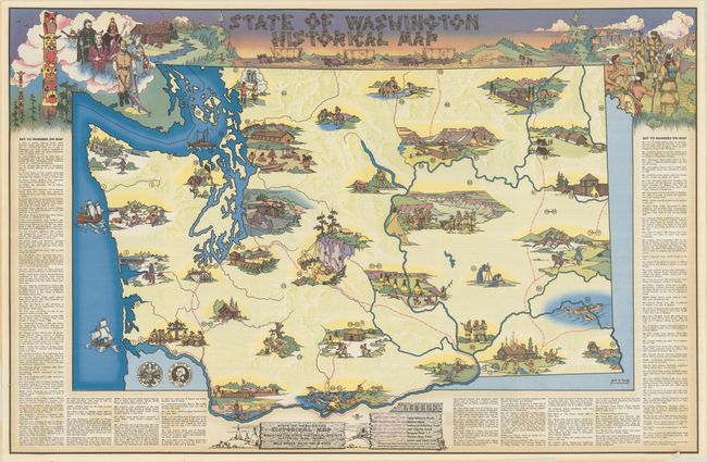
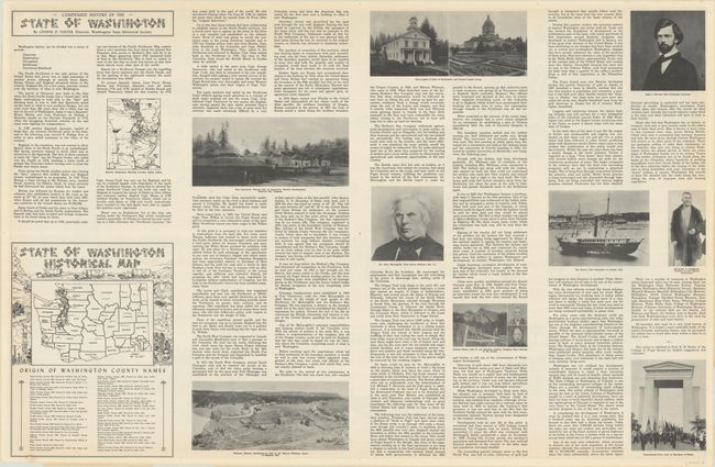
This pictorial map visualizing the state's history was drawn by Jack Moody and published by the Washington State Historical Society. 95 points of interest, accompanied by related illustrations, are numbered to a table flanking the map and describe some of the state's most important events. The first point (#1) marks the "spot in western Jefferson County where Spaniard Heceta and some of his men landed July 14, 1775 - the first white men to step on Washington Soil." The final point (#95) notes that the Oro Fino gold rush "made Walla Walla the largest city in Washington Territory until Seattle passed it in 1880." The author stipulates, however, that "limited space prevents inclusion of many more locations of historical interest." In addition to these points of interest, a legend at bottom identifies various roads and trails delineated on the map including the Mullan Road, Oregon Trail, and Lewis & Clark Trail. Flanking the top border are additional illustrations featuring totem poles, various settlers over time, Mt. Rainer, a wagon train, and a friendly meeting with natives. The verso is filled related text, illustrations, and a small map showing the origin of county names.
References:
Condition: B+
Clean and colorful with an archivally repaired 1" edge tear at top and a small hole in the bottom border.