Subject: San Antonio, Texas
Period: 1948 (circa)
Publication:
Color: Black & White
Size:
26.9 x 35.4 inches
68.3 x 89.9 cm
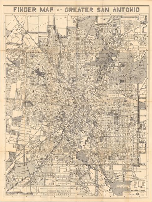
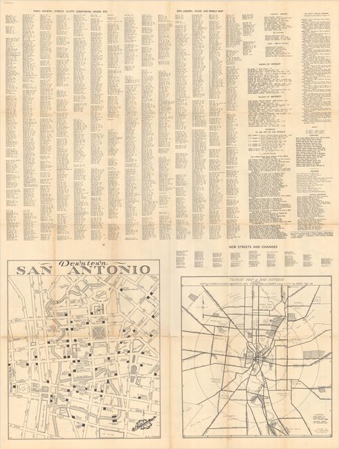
A large detailed street map of the San Antonio region with concentric circles radiating out from downtown at one mile intervals. A legend at bottom right identifies various schools, parks, and cemeteries, while additional points of interest are shaded on the map (Fort Sam Houston, San Jose Mission, Incarnate Word, and more). The Alamo is located at the corner of Alamo Plaza and Houston Street but curiously not emphasized. The verso contains a detailed street index and two smaller maps: Tourist Map of San Antonio (12.3 x 13.3") and Downtown San Antonio (14.7 x 12.5"). Published by Marion Lee Ferguson, who had purchased the previous publisher of this map, the Southwell Map Company. Circa date based on mention on the map of “Expressway of Interstate Highway for Postwar Construction.” There are no past sales records for this map and only one institutional example found on OCLC.
References:
Condition: B+
Issued folding with some light toning along the fold lines. There are numerous short splits at the fold junctions with some minor loss at the junctions along the upper horizontal fold.