Catalog Archive
Auction 207, Lot 311
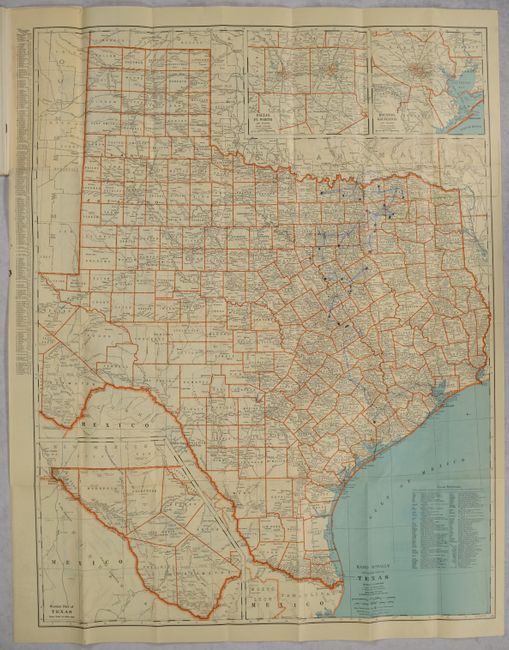
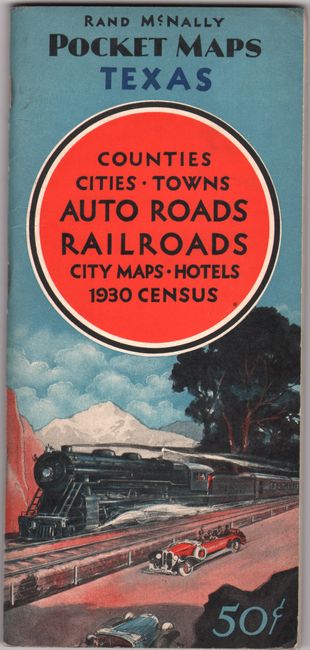
"Rand McNally Standard Map of Texas [on verso] Rand McNally Official 1931 Auto Road Map Texas [in] Rand McNally Pocket Maps of Texas for Tourists, Travelers, Shippers General Commercial and Business Reference", Rand McNally & Co.
Subject: Texas
Period: 1931 (published)
Publication:
Color: Printed Color
Size:
25.3 x 32.8 inches
64.3 x 83.3 cm
Download High Resolution Image
(or just click on image to launch the Zoom viewer)
(or just click on image to launch the Zoom viewer)