Subject: Oregon
Period: 1904 (dated)
Publication:
Color: Printed Color
Size:
34 x 26.8 inches
86.4 x 68.1 cm
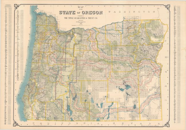
This large, separately issued map, compiled by civil engineers Huber and Maxwell, shows remarkable detail throughout. Information includes townships surveyed, railroads and road right-of-ways, watersheds, and hundreds of towns and settlements. The Cascade Range Forest Preserve is shown in the western part of the state. At sides are extensive lists naming all post offices and railway stations with populations from the census of 1900. This scarce issue was published by Bushong & Co., Map Engravers of Portland, Oregon on behalf of The Title Guarantee & Trust Co.
References:
Condition: A
A crisp, colorful example with a few soft creases. There is a light dampstain in the right margin and a few tiny edge tears along the top edge, all well away from map image.