Subject: Oklahoma
Period: 1904 (published)
Publication:
Color: Printed Color
Size:
6 x 9 inches
15.2 x 22.9 cm
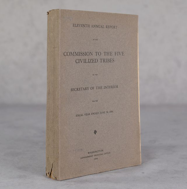
This eleventh annual report includes 202 pages of text containing the commission's report, legislation, enrollment of its citizens, allotment of lands, and contested allotments. Accompanying the report are 5 (of 7) folding maps which illustrate the progress of the allotment work including (missing the allotment status of Creek and Cherokee nations):
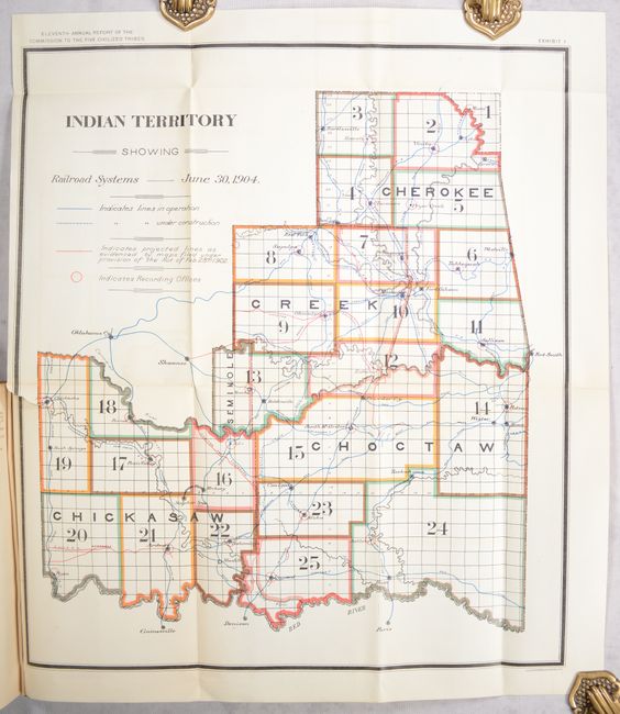
A. Indian Territory Showing Railroad Systems, June 30, 1904, (15.4 x 17.8"). Condition: There is some minor color offsetting and a 1" binding tear at left. (B+)
B. Map of Seminole Nation, (9.2 x 15.3"). Condition: (A)
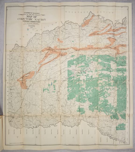
C. Map of Choctaw Nation Indian Territory, (32.6 x 36.8"). Condition: There is a hint of color offsetting and a 1" binding tear at left. (B+)
D. Map of Choctaw Nation Indian Territory Coal and Asphalt Segregation and Pine Timber of Commercial Value, (32.8 x 36.9"). Condition: A hint of color offsetting. (A)
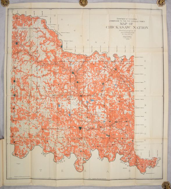
E. Map of Chickasaw Nation Showing Progress of Allotment to June 30 '04, (30.5 x 33.3"). Condition: Minor color offsetting. (A)
The Commission’s report notes the enrollment had been ongoing for six years and that 90% of the tribe population had completed enrollment. More than 200,000 "citizens and claimants" were personally examined. Work was expected to be completed by July 1, 1905. Each claimant would receive 40 acres. The text also provides details regarding the changes in legislation that had to be taken into account, definition of terms and qualification for allotments, etc. This is an important document describing the breakup of the Indian Territory, leading up to its inclusion in the State of Oklahoma in 1907. Gray paper wrappers.
References:
Condition: B+
See description for condition and grades of maps. Text is very good with a stain on one page. Wrappers have light wear with a few chips and tears along the bottom edge.