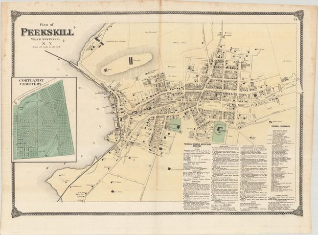
Subject: Peekskill, New York
Period: 1867 (circa)
Publication:
Color: Hand Color
Size:
25.3 x 18 inches
64.3 x 45.7 cm
This detailed plan of the city of Peekskill was issued in Beers' Atlas of New York and Vicinity. The map extends from the Peekskill Iron Company south to the Peekskill Academy and presents the street-grid pattern, individual buildings, property owners, land parcels, the Hudson River Railroad, a fort and barracks, and more. Features an inset map of the Cortlandt Cemetery at left. Drawn on a scale of 25 rods (413 feet) per inch.
References:
Condition: B+
Contemporary color on thin banknote-style paper with some minor toning along the central fold. There is some minor foxing and dampstains confined to the upper blank margins. Issued folding.