Subject: New York
Period: 1838 (dated)
Publication: An Illustrated Atlas, Geographical, Statistical, and Historical, of the United States...
Color: Hand Color
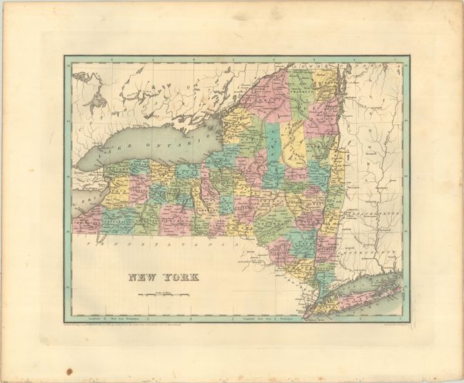
A. New York (14.4 x 11.2"). An attractive map of the state that details county seats, towns and settlements, and river systems. County development is current to 1836 with the addition of Chemung County along the border with Pennsylvania. The map identifies several early canals and railroads, including the Erie Canal that opened in 1825. Not to be confused with the maps from the Comprehensive Atlas, this map is several inches larger and carries much more information. Engraved by G. W. Boynton. Condition: There is minor foxing in the upper image and some light soiling in the margins.
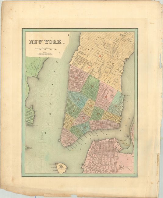
B. New York (11.3 x 14.5"). This detailed map of Lower Manhattan stretches to 53rd street. The city is divided into wards and the map extends to include the tip of Brooklyn, Governors Island, and Jersey City. A numbered key below the title identifies 6 points of interest including the Stock Exchange, Custom House, and Columbia College. Condition: There is some light toning and foxing. The bottom sheet edge is chipped and tattered with a couple of edge tears.
References: Phillips (Atlases) #1381; Ristow pp. 270-271.
Condition: B+
Full contemporary color. See description for more details.