Subject: Montana
Period: 1917 (dated)
Publication:
Color: Printed Color
Size:
25.4 x 15.5 inches
64.5 x 39.4 cm
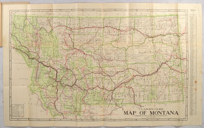
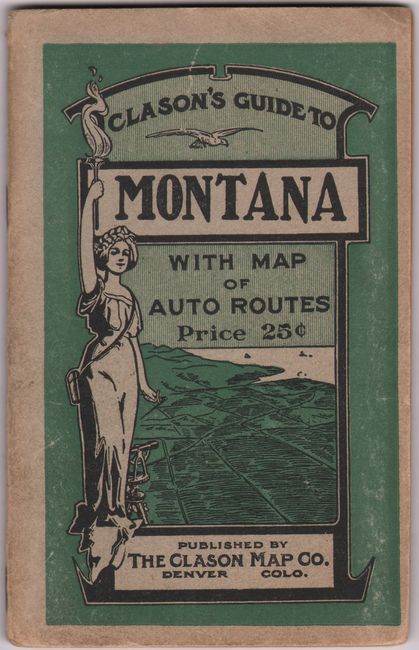
This detailed map of the state uses overprinting to depict county lines (green), national forest boundaries (green hachure), Indian reservations (black hachure), roads (red), and railroads (black). It extends south to include much of Yellowstone National Park. The map folds into pictorial paper wrappers (4 x 6.1") featuring Lady Liberty, and includes a 32-page guidebook.
References:
Condition: B+
Issued folding with several separations along the upper horizontal fold, including a 5" separation and related small tear at left, that have been closed on verso with archival tape. There is faint offsetting and some minor staining in the index at right. Covers have light wear.