Subject: Missouri
Period: 1837 (dated)
Publication:
Color: Hand Color
Size:
18.9 x 25.2 inches
48 x 64 cm
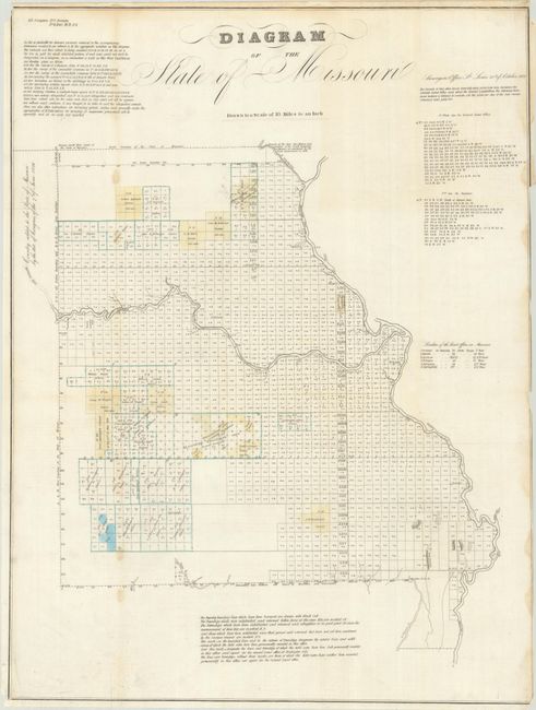
This early GLO map reveals that most surveying in the state is complete except for the northwest and southwest corners. It was issued the year after the Platte Purchase, which added a triangular wedge to the northwest corner of the state "by the act of Congress of the 7th of June 1836" (not yet delineated). The map uses yellow, blue and green outline to indicate various land districts in the west. A table at right names and keys six land offices to the map. Drawn on a scale of 18 miles per inch.
References:
Condition: B
Issued folding and trimmed to just inside the border at right. There are some light stains along the left vertical fold and right sheet edge.