Subject: Boston, Massachusetts
Period: 1920 (circa)
Publication:
Color: Printed Color
Size:
19.2 x 14 inches
48.8 x 35.6 cm
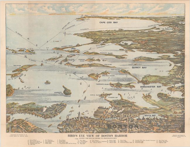
Engraved and printed by Federal Engraving Co., this handsome bird's-eye view of Boston Harbor was produced for the tourist trade. Below the map is a numerical key to 25 landmarks and lighthouses. The map extends as far out as Cape Cod Bay and Provincetown and names East Boston, Governor's Island, South Bay, Dorchester Bay, Quincy Bay, Peddock's Island, Deer Island, Nantasket Beach, Duxbury, and much more. Numerous ferry and ship routes are shown. Published by Union News Co.
References:
Condition: B+
Issued folding with a few fold separations and a 2" tear at right that have all been closed on verso with archival materials. There is a hint of toning at top left.