Current Auction
Lot 272
Current Auction

"New Map of Massachusetts Compiled from the Latest and Best Authorities", Dutton, E. P.

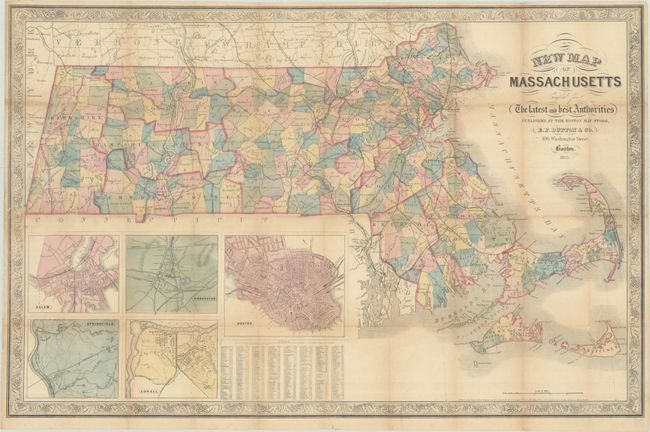
Subject: Massachusetts

Period: 1863 (dated)

Publication:

Color: Hand Color

Size:
30.1 x 19.5 inches
76.5 x 49.5 cm
Download High Resolution Image
(or just click on image to launch the Zoom viewer)

This attractive map delineates the counties of Massachusetts and depicts the state's railroads with bold black lines. Five insets at bottom left offer city plans of Salem, Worcester, Springfield, Lowell, and, of course, Boston. A table at bottom identifies distances between various towns and Boston. The map is surrounded by a beautiful grapevine border. Published at the Boston Map Store, 106 Washington Street.

References:

Condition: B+

Issued folding, now flat, with light toning and numerous small fold separations that have been repaired on verso with archival materials.

Estimate: $200 - $230

Price: $150

Bid Increments
$100 - $249$10
$250 - $499$25
$500 - $999$50
$1,000 - $2,499$100
Terms & Conditions