Subject: Kentucky
Period: 1827 (published)
Publication: A Complete Historical, Chronological, and Geographical American Atlas
Color: Black & White
Size:
19.1 x 11.5 inches
48.5 x 29.2 cm
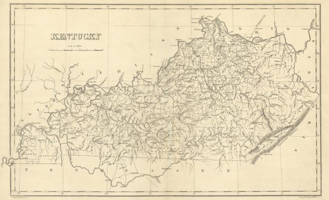
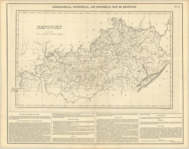
The map is on a full folio sheet (21.9 x 17.5") with English text below giving a brief description of Kentucky's boundaries, productions, rivers, climate, chief towns, manufactures, commerce, education, and religion. The finely engraved map delineates the counties, roads, and major towns. In this edition of the map, Hickman County in the southwest corner of the state has been reduced in size by the additions of Calloway (organized 1823), Graves (1824), and McCracken (1825). Drawn by Fielding Lucas, Jr. and engraved by Young & Delleker.
This is the first time we have encountered this map in black & white.
References: Phillips (Maps) p. 351.
Condition: A
A dark impression on a clean sheet with a few tiny holes only visible when held to light.