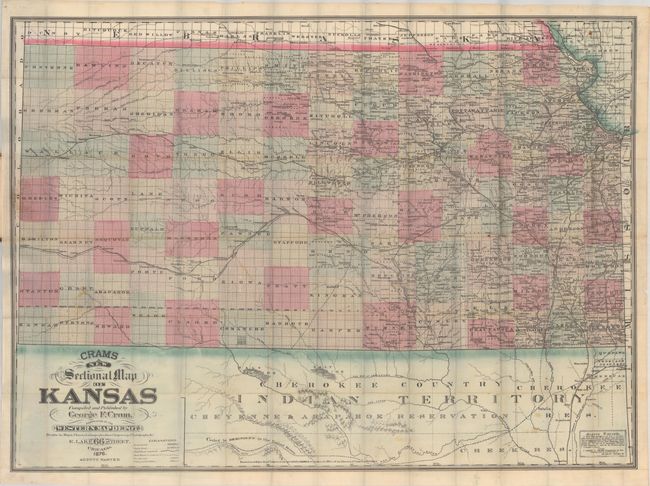
Subject: Kansas
Period: 1876 (dated)
Publication:
Color: Hand Color
Size:
38.2 x 28.2 inches
97 x 71.6 cm
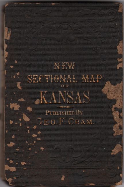
This large and uncommon pocket map of the state delineates counties in full hand coloring with county configurations current to 1875 with the additions of Elk and Chautauqua along the border with Indian Territory. Development extends about halfway across the state with a number of railroads identified, both completed and in progress, including the Atchison, Topeka & Santa Fe, Kansas Pacific, and the Missouri-Kansas-Texas to name a few. The map extends to include the northern portion of Indian Territory, which at the time was dominated by the Cherokee, Cheyenne and Arapahoe tribes. Cram's decorative imprint of the Western Map Depot at 66 East Lake Street in Chicago is located at lower left along with an advertisement in the opposite corner. Folds into brown cloth boards with gilt title on the front cover. Paper label on the inside cover details the "Official Census of Kansas" from 1870, which notes a total population of just under 360,000.
References:
Condition: B+
Issued folding on thin, banknote-style paper with a number of short splits at the fold junctions and some minor staining. Trimmed to the border at bottom as issued. Front cover is detached with some loss of cloth.