Subject: Chicago, Illinois
Period: 1953 (published)
Publication:
Color: Printed Color
Size:
22.2 x 30.3 inches
56.4 x 77 cm
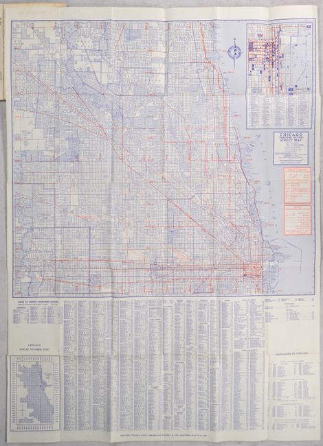
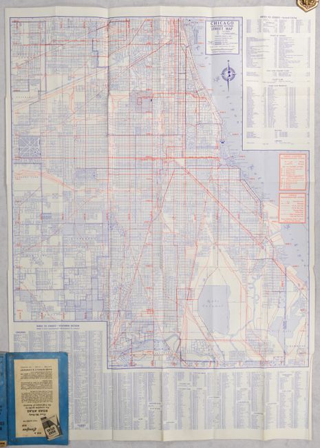
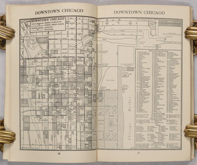
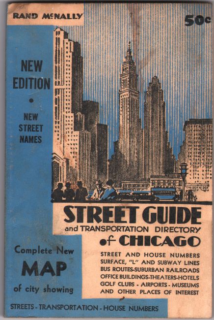
This informative Rand McNally street guide offered a comprehensive overview of the Windy City for just 50 cents. The main attraction is the very detailed double-sided street map tipped in to the back of the guide. The recto depicts the northern part of Chicago, extending from Grant Park north to show suburbs such as Skokie and Evanston. An inset at top right details central Chicago, zeroing in on Grant Park and vicinity, with its own extensive index of buildings and other points of interest. Below the map is a small house number map. On verso is the southern portion of the city, ranging from Lake Calumet north to Douglas Park. The Union Stock Yards and Chicago Midway Airport are prominently shown, along with several other parks, cemeteries, and other notable attractions. Both sides delineate transportation routes, including subway and elevated lines, in red, and include a street index and points of interest. Three smaller maps, showing house numbers, the elevated and subway lines, and downtown Chicago, appear in the text of the guide. The 96-page guide lists streets, transportation, sites of interest, and more, with black & white photographs of the city peppered throughout. Illustrated soft covers (4.7 x 7.1") feature skyscrapers looming over a city scene.
References:
Condition: B+
The folding map is near fine (A), with marginal creasing and a minor glue stain in the top blank margin where the map attaches to back cover. Text is very good with a hint of toning. Covers are lightly soiled.