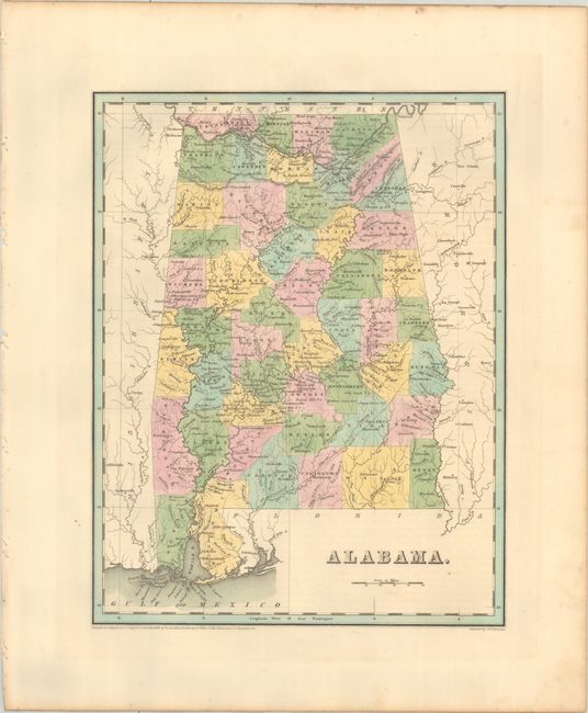
Subject: Alabama
Period: 1838 (dated)
Publication: An Illustrated Atlas, Geographical, Statistical, and Historical, of the United States...
Color: Hand Color
Size:
11.3 x 14.5 inches
28.7 x 36.8 cm
An attractive, early map of the state that details county seats, towns and settlements, and river systems. County development is current to 1836 with the additions of Marshall, De Kalb, and Cherokee in the northeastern part of the state. Three early railroads are delineated, including the Tuscumbia, Courtland & Decatur Railroad in the northern portion of the state along the Tennessee River. Not to be confused with the maps from the Comprehensive Atlas, this map is several inches larger and carries much more information. Engraved by G. W. Boynton.
References: Phillips (Atlases) #1381; Ristow pp. 270-271.
Condition: A
Full contemporary color with a bit of foxing along the sheet edges.