Subject: Western United States
Period: 1927 (dated)
Publication:
Color: Printed Color
Size:
18.1 x 20.4 inches
46 x 51.8 cm
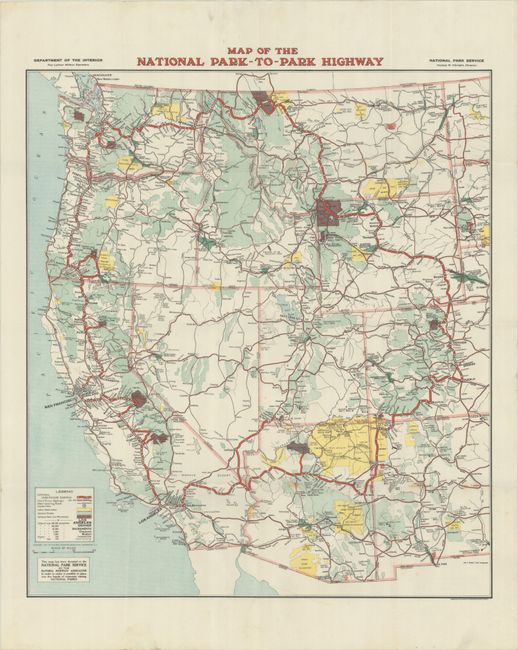
This map of the western United States was a collaboration between the National Highways Association who drafted the map, the USGS that engraved and printed it, and the National Park Service that distributed it, all of whom are credited on the map. The colorful production locates 12 national parks with a legend at lower left that identifies the park-to-park highways, other highways/roads, Indian reservations, national forests, and national parks. The map was part of the successful campaign of the National Highways Association to generate support for a highway system throughout the United States. Blank verso.
References:
Condition: A
Issued folding on a bright sheet with a couple of small spots along the lower horizontal fold.