Subject: Western United States
Period: 1862 (circa)
Publication: Black's General Atlas
Color: Printed Color
Size:
22.2 x 16.8 inches
56.4 x 42.7 cm
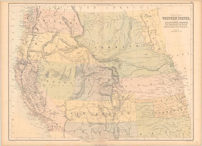
This Scottish-produced map focuses on the early territorial configurations in the West. Washington and Oregon extend to the Continental Divide, and the huge Nebraska Territory spans from the Canadian border to the newly formed Dacotah at the Missouri River. The over-sized Kansas Territory stretches to the Rocky Mountains. The Confederate Territory of Arizona lies beneath New Mexico Territory, between Texas to California. Utah and Nevada have a rare configuration as the boundary line deviates from vertical near Sevier Lake and follows the Virgin River south-southwestward. The map is filled with detail including forts, Indian Lands, topography, watersheds, and more. Drawn and engraved by John Bartholomew. Using an early technique, it is " Printed in Colours by Fr. Schenck, Edinburgh."
References:
Condition: B+
There is some light offsetting in two corners, faint toning along the centerfold, and a bit of foxing.