Subject: Western United States
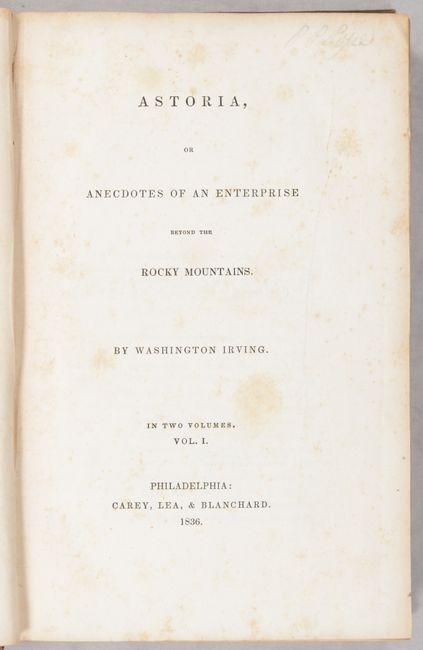
Period: 1836 (published)
Publication:
Color: Black & White
Size:
17.6 x 9.8 inches
44.7 x 24.9 cm
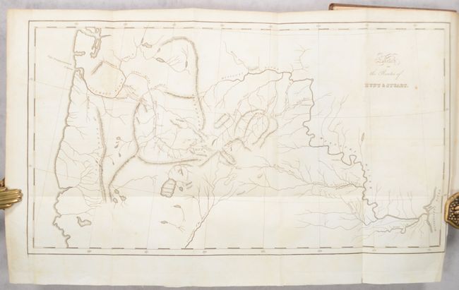
Describing an expedition launched just a few years after Lewis & Clark's epic journey, this map covers the same region - from the junction of the Mississippi and Missouri, up the Missouri, across the Rocky Mountains and through the Pacific Northwest, extending to well below Lake Bonneville Salt Water. The southern portion of the map is mostly blank except for a long, straight Colorado of the West with many tributaries originating in the Rockies. The Great Basin region has three lakes and a few land-locked rivers. The routes of the two explorers are delineated with dotted lines with Stuart's party reaching all the way to Astoria near the mouth of the Columbia River. The map is the result of a commercial exploration directed by John Jacob Astor. The expedition was sent in 1811 to seek an overland route to the Pacific. Washington Irving was commissioned by Astor to write the account of his company's effort to create a settlement in Oregon. Wheat says "for what it purports to be it is an excellent map."
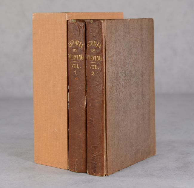
The account and map were not published until 1836. It was reportedly engraved by Carey, Lea & Blanchard, but no attribution is given on the map. Here it is bound into the front of volume two of the 1836 first edition (volume 1 - 285 pages, volume 2 - 279 pages). Bound in brown cloth with gilt titles on spine. This example comes with a modern slipcase of orange cloth over cardboard.
References: Wheat (TMW) #419; Howes #I-81.
Condition: B+
The map has light toning, minor offsetting, and a 0.5" binding tear that has been closed on verso with archival tape. There is light scattered foxing throughout the text of both volumes. Front hinge is starting on Volume I and the spine backstrip is cracked. Covers are lightly worn and sunned.