Subject: Kansas & Nebraska
Period: 1857 (dated)
Publication:
Color: Hand Color
Size:
17 x 25.7 inches
43.2 x 65.3 cm
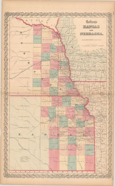
Early map in a vertical configuration covering the eastern quarter of these young territories. Only 34 counties are organized in Nebraska and 37 in Kansas. The river systems are well developed and the only road is the Santa Fe Road, originating in Kansas City. There is no sign of Wichita, Topeka is just a little town, and the capital is shown as Lecompton. Indian tribes are located throughout Kansas, including the Delaware, Pottawottamie, Sacs & Foxes, with the familiar grid pattern of the Public Survey System freshly laid on top. This region was Indian Territory until 1854.
References:
Condition: B+
Contemporary color with a bit of foxing along the centerfold, faint offsetting, and light toning mostly along the sheet edges.