Subject: Colonial Mid-Atlantic & Southeast United States
Period: 1778 (dated)
Publication:
Color: Black & White
Size:
34.1 x 23.1 inches
86.6 x 58.7 cm
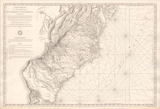
This large, handsome, and important Revolutionary War chart was published by the Depot de la Marine for the French fleet when the focus of the war shifted to the south. The chart extends from Delaware Bay and Philadelphia south through much of Georgia to Amelia Island and St. Johns River. It provides excellent detail along the coast, particularly in the Chesapeake Bay. Surprisingly, it also provides great detail inland to the Appalachians and extends west to Fort Necessity and the Ohio River in Western Virginia. The map shows early county names throughout the region, as well as early roads, Indian tribes, towns, mountains, and rivers. Numerous native tribes are noted and the location of the Catawba Indians ,Catawbaw Town, is shown south of Charlotte. Two Quaker meeting houses are shown east of Salem, NC. The Depot de la Marine engraved seal appears below the title cartouche, and the price is engraved at bottom right: "Prix Trois Livres."
References:
Condition: B+
A handsome impression on a sturdy sheet backed in linen. There is a short centerfold separation at bottom that has been repaired on verso, a few light spots, and minor offsetting at top.