Subject: Eastern United States
Period: 1826 (dated)
Publication:
Color: Black & White
Size:
35.4 x 24.1 inches
89.9 x 61.2 cm
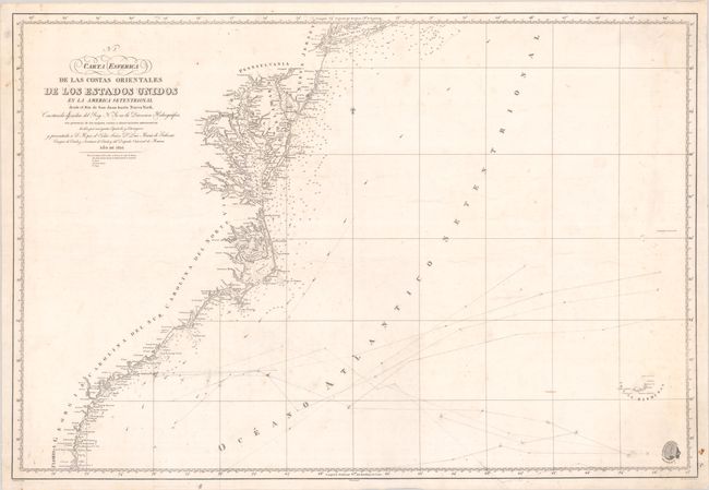
This scarce and detailed Spanish chart extends from the St. Johns River, Florida north to the Chesapeake Bay and New York Harbor. Cities and towns are named along the coast including Savannah, Charleston, Norfolk, Washington, D.C., Baltimore, and Philadelphia, but most of the detail is focused on the various waterways meeting the Atlantic. The Chesapeake Bay is rendered in particularly fine detail. Navigational details include numerous depth soundings, shoals, offshore islands, currents, and more. Drawn by C. Noguera and engraved by R. Esteve. Adorned by the insignia of the Direccion de Hidrografia in the bottom right corner.
References:
Condition: B
There is some scattered foxing, light soiling, and manuscript notations in the Atlantic Ocean. A small hole in the bottom right border has been archivally repaired with a tiny portion of border in facsimile.