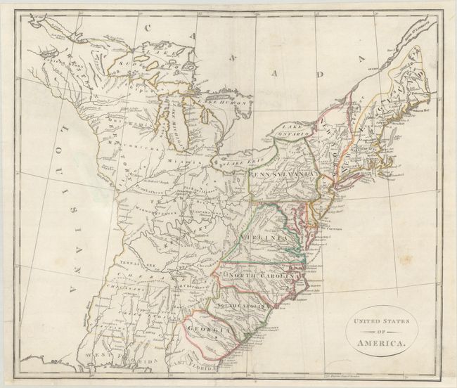
Subject: Eastern United States
Period: 1799 (circa)
Publication: Atlas to Cruttwell's Gazetteer
Color: Hand Color
Size:
15.6 x 13.6 inches
39.6 x 34.5 cm
An attractive map of the nascent United States extending from Maine to East & West Florida and west to the Mississippi River. In the far northeast, Sagahadok is a large region above Main, and the map also shows New York and Pennsylvania both bordering Lake Ontario. The Trans-Appalachia region names both Kentucky and Tennassee though neither has borders. The vast majority of this region is comprised of various Indian lands. Above the Ohio River lies a huge Western Territory where Lake Superior is unapologetically filled with fictitious islands. The region west of the Mississippi River is labeled Louisiana but is completely void of details.
References: McCorkle #799-10; Phillips (A) #692-7.
Condition: B+
Issued on paper with a "W S 1799" watermark and remargined at bottom with much of the border redrawn in facsimile. There are a couple short repaired edge tears at bottom, some paper weakness in a blank area adjacent to Louisiana, and a couple of small stains.