Subject: United States
Period: 1951 (dated)
Publication:
Color: Printed Color
Size:
30.8 x 18.3 inches
78.2 x 46.5 cm
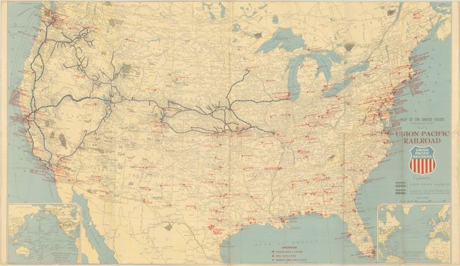
This promotional railroad map shows the routes and connections (both double and single track) of the Union Pacific Railroad, with a special emphasis on military sites. The routes branch west from Chicago. Airfields, bases & stations, naval installations, and barracks, camps, forts & posts are indicated with red overprinting. Inset maps at bottom left and bottom right show connecting lines over the Pacific and Atlantic. Copyright is credited to C.J. Collins. Self-folds into covers with the alternate title Military Map of the United States. Second edition, October 1951.
References:
Condition: B
Issued folding with a few short fold separations, including a 2" horizontal split at center with minor loss of image. There is light toning along some folds and a few dampstains in the margins. Narrow upper and lower margin, as issued.