Subject: United States
Period: 1868 (circa)
Publication:
Color: Hand Color
Size:
28.3 x 16.6 inches
71.9 x 42.2 cm
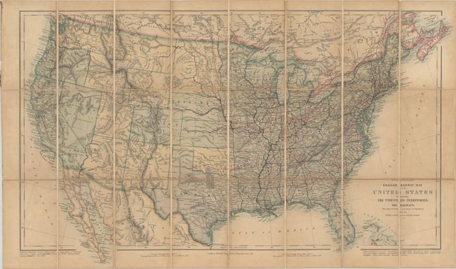
This is an uncommon early edition of this pocket map of the United States with superb detail of the early rail system. Published in London, it reflects the European fascination with American railroads. The Union Pacific Railroad, which would be completed in Utah the following year (1869), crosses the western territories, but unlike later editions there are no spurs into Colorado's mining regions. Otherwise the railroads are confined east of the 100th meridian, aside from a short track between Oroville and Benecia in California. Wyoming Territory is not yet shown and is part of Dacotah Territory. Idaho is a territory, with its panhandle still a part of Washington Territory. Topography is well delineated, and there are numerous Indian tribes and forts. Dissected and backed with linen.
References:
Condition: B
Contemporary color with some toning on a sheet that has been dissected and backed with linen. There are a few short fold separations along the linen and a few small spots.