Subject: United States, Texas
Period: 1846 (circa)
Publication:
Color: Hand Color
Size:
12.3 x 9.1 inches
31.2 x 23.1 cm
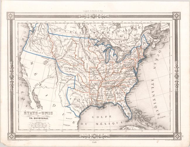
This interesting map of the United States shows Mexico encompassing the majority of the Southwest and California. Texas is shown as an independent Republic in its smaller configuration though still extending to the Rio Grande. Most of the states east of the Mississippi River are named and outlined, except for Wisconsin, which is called District Huron. Besides Missouri, Arkansas, Louisiana, and Texas, land west of the Mississippi River is separated into districts, including District of the Mandines, District of the Osages, District of the Ozark, District of the Sioux, and District of the Oregon. Canada is called Nouvelle Bretagne. The map features decorative borders with graphic elements in the corners and four distance scales.
References:
Condition: A
A crisp impression on a bright sheet with a small chip in the bottom blank margin.