Subject: United States, Texas
Period: 1838 (dated)
Publication: An Illustrated Atlas, Geographical, Statistical, and Historical, of the United States...
Color: Hand Color
Size:
22.9 x 14.2 inches
58.2 x 36.1 cm
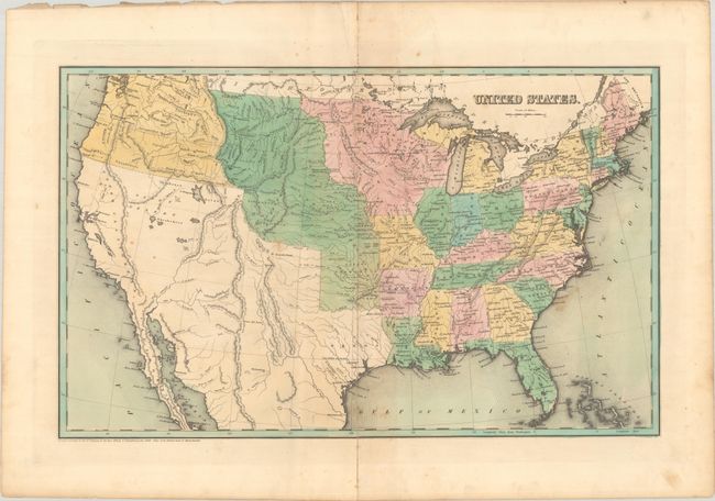
This attractive map presents the developing United States with Missouri and the new state of Arkansas demarcating the western frontier. Though its borders are not delineated, Texas is a Republic with Houston noted as the capital city. Mexico is in control of the rest of the Southwest, while to its north a large Indian Territory reaches westward through the Great Desert to the Rocky Mountains and north to the border with Canada. Wisconsin and Iowa are named but not delineated in the region formerly called Northwest Territory. Oregon takes in present-day Oregon and Washington and encroaches into present-day British Columbia. The map is filled with early towns and settlements in the Midwest, but there are only a few forts located in the West, which is dominated by various native groups north and west of the Missouri River.
References: Phillips (Atlases) #1381; Ristow pp. 270-271.
Condition: B
Contemporary color with some light foxing and staining. A 6.5" centerfold separation at bottom has been archivally repaired on verso.