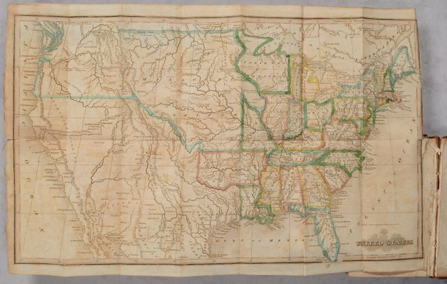
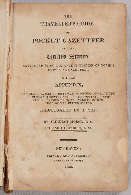
Subject: United States
Period: 1823 (published)
Publication:
Color: Hand Color
Size:
16.9 x 10.2 inches
42.9 x 25.9 cm
This uncommon map of the United States shows early territorial configurations in the middle of the country. Arkansas is in its large configuration extending to Mexico, while Texas is named and is part of Mexico. The large Northwest Territory is bounded on the west by the Mississippi River and stretches to Lake Superior and Lake Michigan. The central plains and Northwest are labeled Missouri Territory, and the western boundary with Canada is undefined around New Caledonia. In Utah a lake is shown whose "Western Limits...are unknown" and just to the east is the Valle Salado. An unknown, spurious river bisects the unnamed Great Basin with a hopeful notation predicting it "will probably be the communication between the Atlantic and Pacific." Still bound in the front of Morse's 324-page Pocket Gazetteer. 16mo., hardbound in full contemporary leather.
References: Howes #M-839.
Condition: B
The folding map has toning and offsetting, a short repaired binding tear along the right border, and a tiny hole only visible when held to light. Text has moderate scattered foxing. Hinges are starting with the front hinge partially glued down. Covers are lightly worn with bumped corners.