Current Auction
Lot 128
Current Auction

Revolutionary War-Era Sea Chart Covering New England & Eastern Canada

"Carte Reduite des Cotes Orientales de l'Amerique Septentrionale Contenant Celles des Provinces de New-York et de la Nouvelle Angleterre, Celles de l'Acadie ou Nouvelle Ecosse, de l'Ile Royale de l'Ile St. Jean...", Sartine

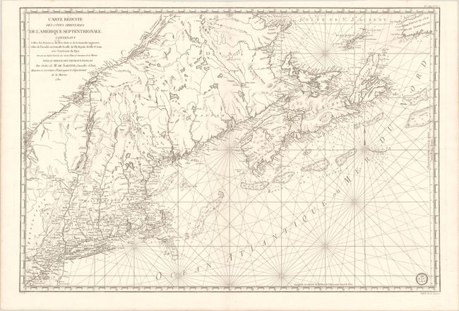
Subject: Colonial Northeastern United States & Canada

Period: 1780 (dated)

Publication: Neptune Americo-Septentrional

Color: Black & White

Size:
34.3 x 23.1 inches
87.1 x 58.7 cm
Download High Resolution Image
(or just click on image to launch the Zoom viewer)

This fine chart was prepared under the direction of Antoine Sartine, Minister of Marine in Paris, for use by the French Navy during the American Revolutionary War. It covers the region from Chaleur Bay to New Jersey and includes Prince Edward Island and Cape Breton Island. The chart provides excellent detail of the harbors, bays, inlets, shoals and fishing banks, currents, and navigational hazards. In addition to the hydrographical detail it also includes interior information on the towns and forts in New England. The reference in the title to vaisseux du roi has been changed to vaisseux Francais, indicating publication after the French Revolution (circa 1790). The engraved Depot de la Marine stamp appears at bottom right. This is the second state with No. 1 (Hyd. No. 61) in top right margin and Prix Trois Livres in bottom right margin.

References: McCorkle #780.3; Kershaw #754; Sellers & Van Ee #216.

Condition: A

A crisp impression on a clean bright sheet with a couple of minor stains at top right and left.

Estimate: $1,100 - $1,400

Current High Bid:
$0

Reserve: Reserve Not Met
Next Bid: $550

Bid Increments
$500 - $999$50
$1,000 - $2,499$100
$2,500 - $4,999$250
$5,000 - $9,999$500
Terms & Conditions