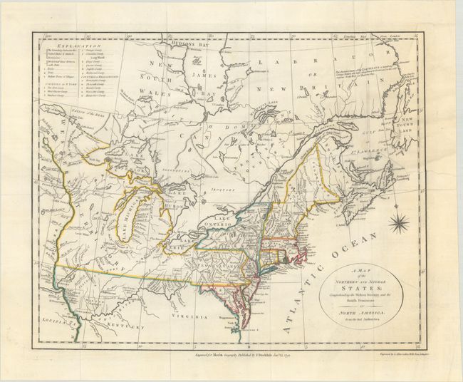
Subject: Eastern United States & Canada
Period: 1792 (dated)
Publication: Morse's Geography
Color: Hand Color
Size:
15.3 x 12.3 inches
38.9 x 31.2 cm
This uncommon and information-packed map describes the region from James Bay to Chesapeake Bay and the confluence of the Mississippi and Ohio Rivers, and from the Lake of the Woods to the Gulf of St. Lawrence. A key in the upper left corner provides an explanation of the various symbols used in the map. Several of the districts and states are shown with distorted borders, but the most interesting feature of the map are the numerous Bounty Land Grants shown in the western frontier including Genl Clarks, Donation Lands from the Commonwealth of Virginia, and Ohio Company in Ohio, and Wabash Company, New Jersey Company, and Illinois Company in Illinois. Much of the information is taken from Amos Doolittle's map of the same title. This is the second state. Engraved by G. Allen Sanders, Wells Row, Islington.
References: McCorkle #792.1; Kershaw #389.
Condition: B+
Issued folding and now flat with professional repairs to a 6" edge tear at right and a few short fold separations in the bottom blank margin.