Subject: World
Period: 1703 (published)
Publication: Atlas Novus
Color: Hand Color
Size:
13.7 x 8.9 inches
34.8 x 22.6 cm
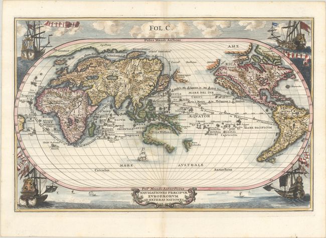
Splendid map of the world on an oval projection showing California as an island and a partially mapped Australia and New Zealand. This map is from the series produced by Scherer, who was a mathematics professor and devout Jesuit. It shows the sailing routes to the East Indies across the Pacific, around the Cape of Good Hope, and (optimistically) through a Northeast Passage to Japan. The corners are richly decorated with sailing ships representing the four major European powers, Holland, France, Spain and Britain.
References: Manasek #65; Shirley #631; Shirley (BL Atlases) T.SHER-1a #109.
Condition: A
A sharp impression on a bright sheet with a hint of toning along the centerfold.