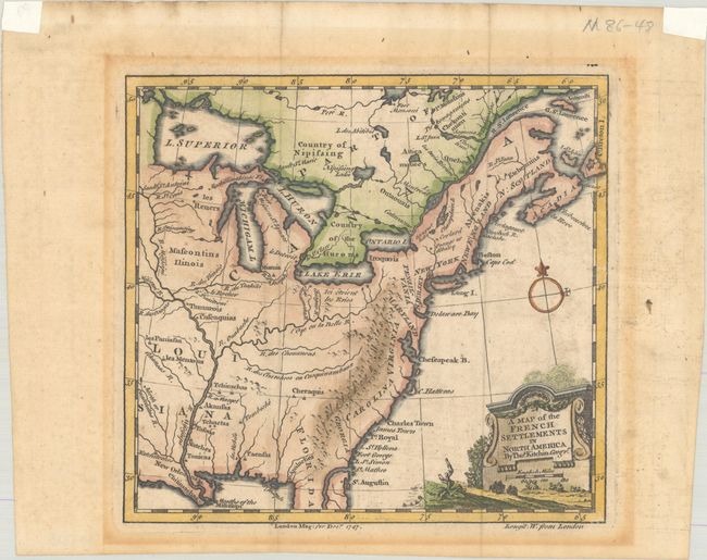
Subject: Colonial Eastern United States & Canada
Period: 1747 (dated)
Publication: London Magazine
Color: Hand Color
Size:
7.2 x 6.7 inches
18.3 x 17 cm
This map shows the French and British colonies in North America prior to the French & Indian War. It extends just beyond the Mississippi River and north to include all of Lake Superior. Major rivers are delineated, with the St. Johns River prominently shown but not named. Native American tribes are also located, including the Mascontins (Mascouten), Cheraquis (Cherokee), and Nipissing. The Appalachian Mountain extend south into Florida. In the far west, Natchitoches, New Orleans, and Naches are located. This is an early work by Kitchin as his first known work was executed in 1745. Published in the December 1747 edition of the London Magazine.
References: Jolly #LOND-28; McCorkle #747.1.
Condition: B+
A crisp impression, issued folding on a faintly toned sheet with mat burn outside of the map image. There are remnants of framing tape in the top corners of the sheet on recto.