Subject: Eastern North America & West Indies
Period: 1783 (dated)
Publication:
Color: Hand Color
Size:
25.6 x 18.8 inches
65 x 47.8 cm
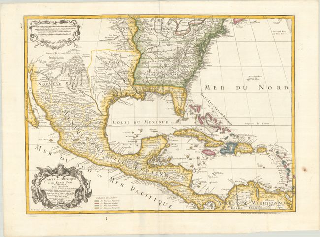
The title of this map contains a very early recognition of the newly formed United States, as 1783 is the earliest that the name appears on a printed map. This is the last issue of Delisle's map that was first issued in 1703 with the title Carte du Mexique et de la Floride. Delisle's map is regarded as the first map to correctly show the course of the lower Mississippi, to accurately place the Great Lakes, and to locate many English coastal settlements. Its longevity and numerous copies by other mapmakers attest to the importance of this engraving. Dezauche was Buache's son-in-law, and the successor to the Delisle business. In Dezauche's edition the original title on the map was altered to include the words Etats Unis and also a legend with color-coding were added to show the colonial possessions of England, France, and Spain, and the extent of the United States.
References: Tooley (Amer) p.22 #53; cf. Cumming (SE) #137; Martin (TX) p.92-3.
Condition: A
A fine impression on a bright sheet with contemporary outline color and the watermarks of "T[heart]Richard Auvergne" and a Maltese cross encircled in rosary beads. There is a rust spot in the right blank margin.