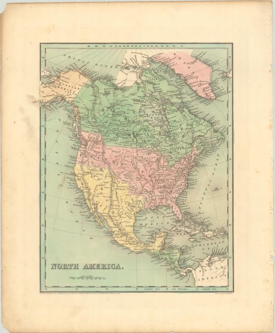
Subject: North America
Period: 1838 (dated)
Publication: An Illustrated Atlas, Geographical, Statistical, and Historical, of the United States...
Color: Hand Color
Size:
11.7 x 14.4 inches
29.7 x 36.6 cm
This attractive copper-engraved map shows settlement extending to the Missouri River with Arkansas, Missouri and Wisconsin Territory representing the frontier. In the Northwest, the border between the United States and Canada extends well into present-day British Columbia, reflecting U.S. interests in the area. Mexico is in control of the Southwest and Texas, despite the atlas being published during the Republic years. Only three cities are named in Texas including Houston, San Antonio and Nacogdoches. In the Great Basin, there is a large spurious Lake Timpanogos along with several small lakes within the "Sandy Desert." Alaska is Russian America. Engraved by G.W. Boynton.
References: Phillips (Atlases) #1381; Ristow pp. 270-271.
Condition: B+
Full contemporary color with a bit of soiling at left. There are a few tiny chips along the sheet edges and binding holes in the far right margin.