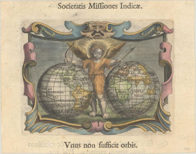
Subject: World
Period: 1640 (published)
Publication: Imago Primi Saeculi Societatis Jesu
Color: Hand Color
Size:
5.4 x 4.1 inches
13.7 x 10.4 cm
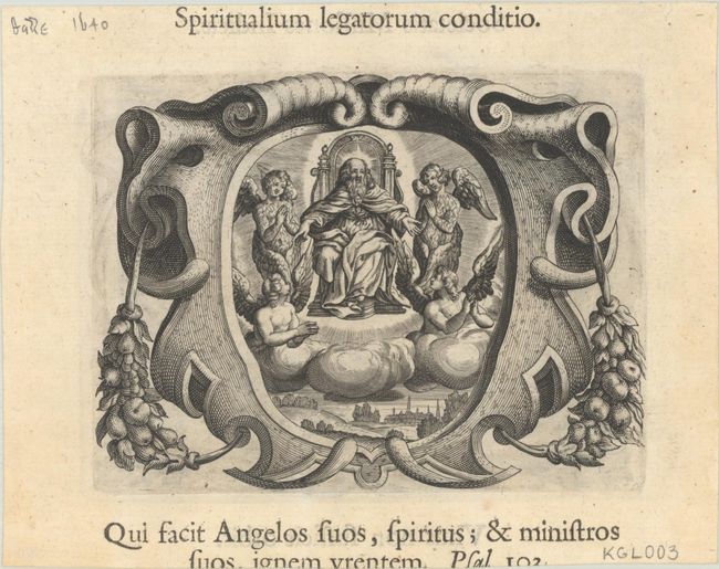
This uncommon, small double-hemisphere world map was published in the only Latin edition of Plantin's emblem book celebrating the centenary of the Jesuit Order. A cherub stands between the hemispheres with a bow and arrow. The Americas appear in an odd configuration, with California shown as an unnamed island below an expansive northwest coast that stretches off the edge of the map. The present-day United States and Canada are simply labeled Nova Francia. There is a protruding peninsula in South America, perhaps the Yucatan Peninsula located too far to the south. The coast of a vast, unknown southern continent is delineated in the Eastern Hemisphere. The map is surrounded by an ornate strapwork border. On verso is another emblem with God on a throne surrounded by angels.
References: King (3rd ed.) #1640; Shirley #352.
Condition: A
A crisp impression on a clean, bright sheet. The text above and below the engraving has been trimmed off the sheet.