Subject: Colonial North America
Period: 1719 (dated)
Publication: Le Nouveau et Curieux Atlas Geographique et Historique
Color: Hand Color
Size:
8.7 x 6.6 inches
22.1 x 16.8 cm
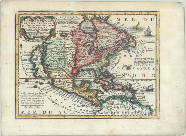
Charming, exquisitely detailed map of the continent featuring the island of California with an indented northern coast and Cap Blanc, Port des Roys and Pointe de la Cair at its northern end. The British colonies are shown confined east of the Appalachians, with France in control of the region between there and the Mississippi River. Spain controls all of the West and Florida. Several short notes fill the map, including information on the island of California and the fishing banks off the coast of Newfoundland. The decorative title cartouche is flanked by two serpents. Two ships and a sea monster fill the Atlantic.
References: McLaughlin #191; Mickwitz & Miekkavaara #43-6; Shirley (BL Atlases) T.MEN-1b.
Condition: A
A nice impression with contemporary color in the map and later color in the cartouche, on a sheet with binding holes in the left margin and light soiling that is confined to the edges of the sheet.