Subject: Atlases
Period: 1882 (published)
Publication:
Color: Printed Color
Size:
11.3 x 15 inches
28.7 x 38.1 cm
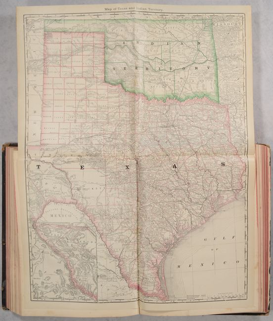
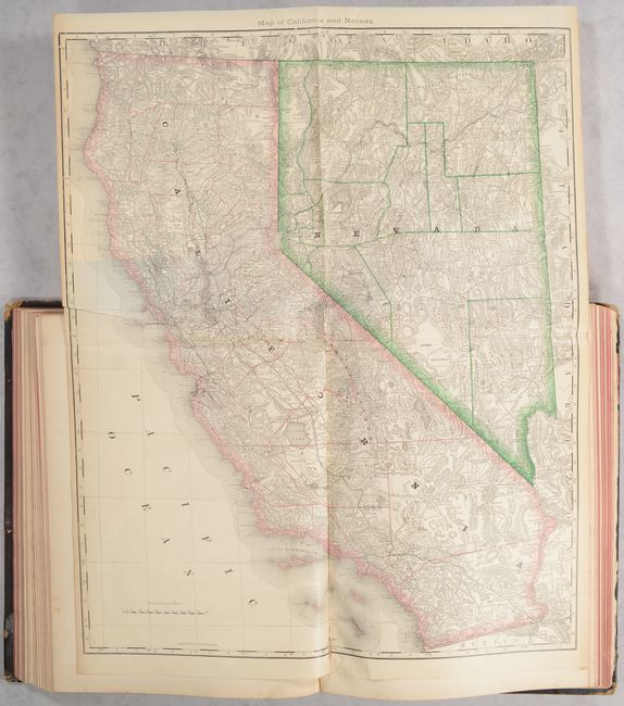
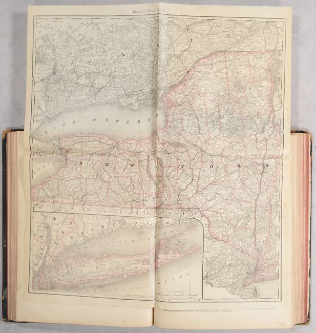
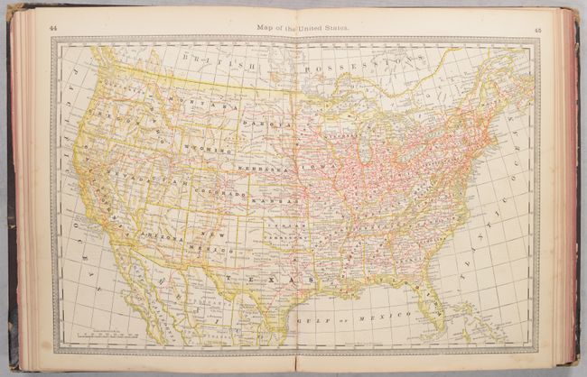
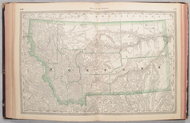
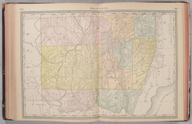
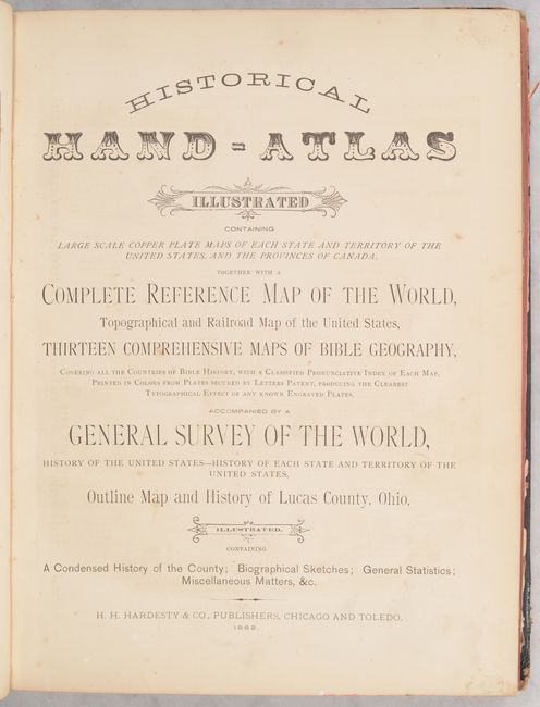
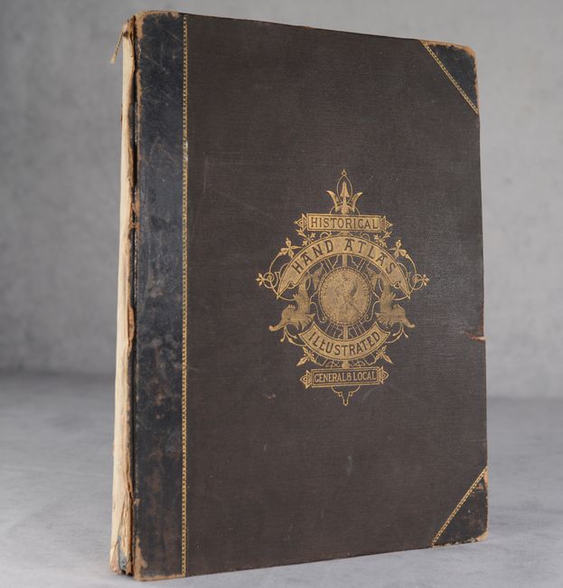
This atlas is titled as a historical atlas, but is mostly a modern atlas of the United States and Canada with 13 biblical maps on 10 single sheets. It contains a vast amount of historical information on the United States, each individual state, and a special 62-page section on Lucas County, Ohio including a single-page map of the county. There are a total of 33 double-page maps, 24 single-page maps, and 5 large folding maps (New York, Ohio, Illinois, Texas and Indian Territory, and California and Nevada) within the atlas. The folding Map of Texas and Indian Territory (19.2 x 24.7") shows good detail of roads, completed railroads, and projected railroads. Tom Green County is shown in a large, early configuration, not yet divided into Sterling, Irion, Coke, and Midland. In Greer County in southwestern Indian Territory two boundaries are shown: “Boundary Claimed by the State of Texas,” and “Boundary Claimed by the United States.” The dispute was ultimately decided by the Supreme Court which accepted the United States boundary and Greer County became part of the Indian Territory. 259 pages. Hardbound in quarter calf with tips over brown cloth boards with illustrative gilt title on the front cover.
References:
Condition: B
The maps are mostly very good to near fine with overall light toning and occasional foxing (B+). The folding map of Ohio has an area of small loss at center, minor staining, and some creasing at top (B). Covers are very loose with the back cover nearly detached. Both boards have moderate shelf wear. Spine backstrip has perished.