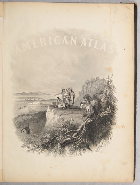
Subject: Atlases
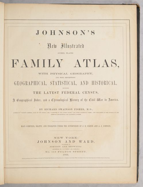
Period: 1863 (published)
Publication:
Color: Hand Color
Size:
14.9 x 18.6 inches
37.8 x 47.2 cm
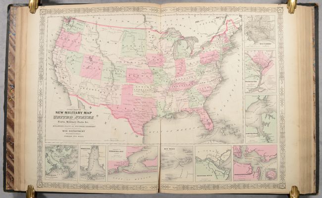
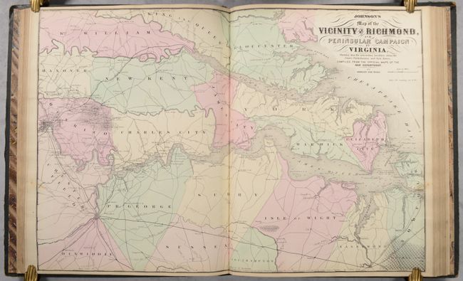
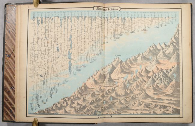
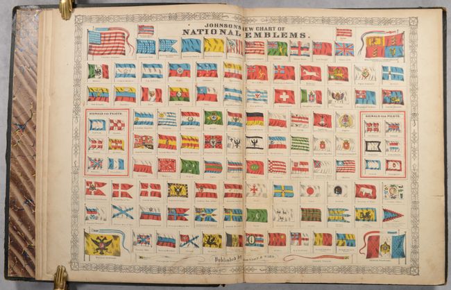
This atlas is complete with 66 beautifully rendered, steel engraved maps, including 34 double-page maps. There are several thematic maps and diagrams interspersed throughout the text that display the geology, weather, tides, agriculture, flags and animal kingdoms of the world. This 1863 edition is the last year with steel engraved plates, with many of the maps featuring vignettes, and some retaining the early strap-work style borders. It also has the desirable edition of the New Military Map of the United States which shows all state and territory boundaries rather than the limits of military divisions. And it features the un-numbered double-page Civil War map Vicinity of Richmond.
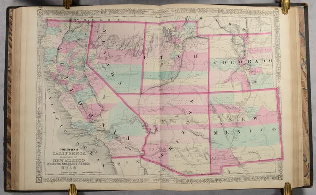
The Southwest map is the late 1863 - early 1864 edition in this series of maps. Arizona still claims the Southern tip of Nevada and has the county configurations of the old New Mexico Territory, with the addition of Castle Dome and Ewell counties in the south. The Utah/Nevada border is now at 115°. This is a completely new plate with extensive revisions in the watershed and mountain detail and several of the earlier notations removed. But it retains the note in the area of Quartzite, Arizona calling the area "exceedingly fertile and abundantly timbered and well watered." The map details the U.S. Mail routes, the Emigrant roads to California, the proposed railroad route through Utah, Nevada and California, and the Pony Express trail.
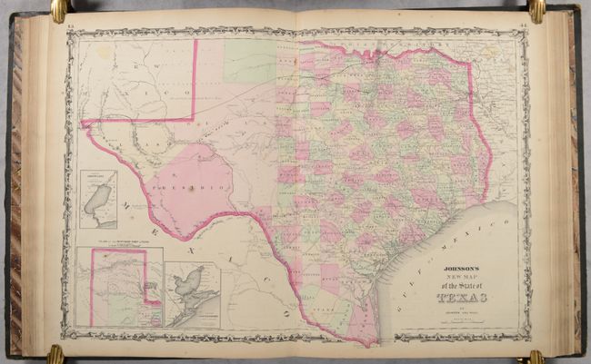
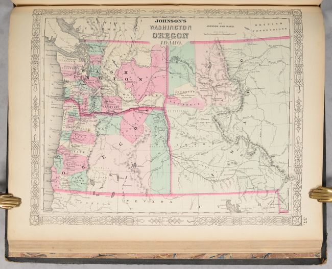
The double-page map of Texas shows county development mostly in eastern Texas and only the three large counties of El Paso, Presidio and Bexar in the west. The panhandle, noted as the Staked Plains (Elevated Table Land, without Wood or Water), includes a large section that is unorganized. There is nice depiction of the wagon roads, many named, with several completed railroads. The inset maps include a 'Plan of Sabine Lake,' 'Plan of the Northern part of Texas,' and 'Plan of Galveston Bay.' The map of the Northwest shows the newly created territory of Idaho. The map of Minnesota shows the newly created region of Dakota with an undefined western boundary.
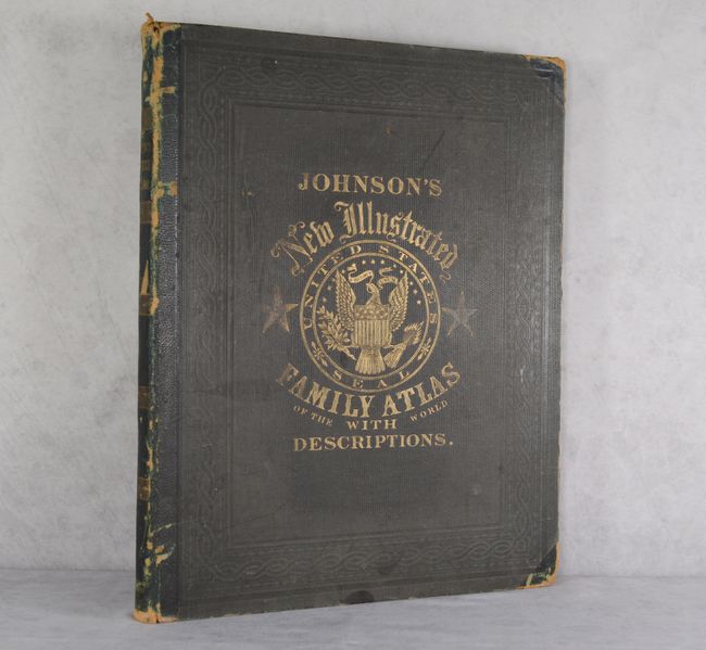
Hardbound in original quarter calf and tips over embossed green cloth covers, titling in gilt on front cover and spine, and marbled endpapers. This example includes a note pasted to one of the front free-endpapers stating that extra guards have been included in the atlas so that the owner could insert additional maps as they became available, and that if important geographical or political changes occurred, the publishers would send the map "free of expense, on receipt of fifteen cents for each map."
References:
Condition: B+
Overall the maps are in very good condition with light toning, foxing and soiling. There are light dampstains along the top and right edges of about 15 pages within the atlas. The military map of the US has a long centerfold separation at bottom, and several maps have very short centerfold separations or tears at bottom. There is a previous owner's name written in ink on the front free-endpaper. The hinges are starting and the covers are soiled with small abrasions and have darkened in color. The spine has a number of abrasions and small chips at top and bottom. A nice example that is still fully intact.