Subject: Western Hemisphere - America
Period: 1787 (circa)
Publication:
Color: Hand Color
Size:
21.6 x 12.4 inches
54.9 x 31.5 cm
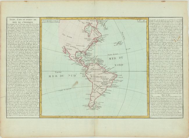
This map of the Americas is presented in a style that gained great popularity in France at the end of the 18th century, where the map is flanked by lengthy text panels. The map itself presents very little inland detail and the western coast of North America is not delineated and noted as Parts Unknown (Pays inconnu). There is good detail of the coastline along both continents naming places such as Long Island, Charlestown and Cape Horn. The map size is 13.5" x 12.5".
References:
Condition: B+
A nice impression with full contemporary color on a sheet with a bunch of grapes watermark. There is a stain in the south Pacific and in the text at right, toning and soiling along the edges of the sheet, and an archivally repaired centerfold separations at top and bottom.