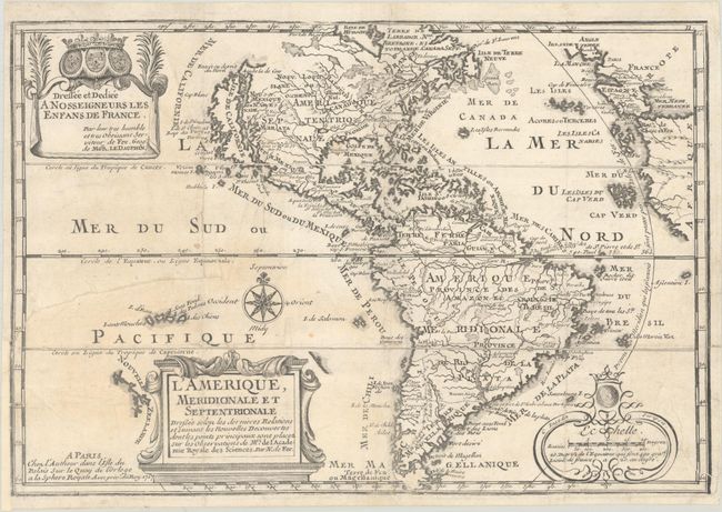
Subject: Western Hemisphere - America
Period: 1717 (dated)
Publication: L'Atlas Curieux ou le Monde...
Color: Black & White
Size:
13.2 x 8.9 inches
33.5 x 22.6 cm
This charming map of the Americas is a reduced derivative of De Fer's classical wall map of 1698 with information gathered from the archives of the Academie Royale des Sciences.  The island of California covers the entire west coast of North America north of the Tropic of Cancer with two large imaginary islands off shore.  One of the prominent features in northern Mexico is Les Mine de S. Iean et de Ste. Barbe, the legendary Santa Barbara mines of the Chihuahua-Durango region.  There are several large spurious lakes on both continents.  A partial coastline of New Zealand appears beside the title cartouche.  The map is richly decorated with three cartouches and a compass rose.  This is the third state.
See also lot 738 for Philip Burden's The Mapping of North America - A List of Printed Maps 1511-1700 that describes this map.
References: Burden #759; McLaughlin #135, Pastoureau, FER I D; Tooley (Amer) #61, p. 126.
Condition: B
Issued folding, now flat and backed with archival materials to repair some short fold separations and a 4.25" edge tear at left.  There is light toning at left and a printer's crease at bottom right.