Catalog Archive
Auction 206, Lot 617

"A New and Accurate Map of the Empire of Japan, Laid Down from the Memoirs of the Portuguese and Dutch; and Particularly from the Jesuit Missionaries...", Bowen, Emanuel
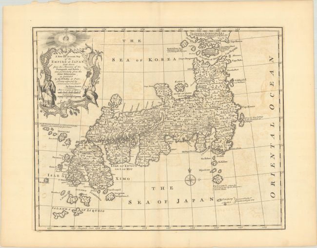
Subject: Japan

Period: 1747 (published)

Publication: A Complete System of Geography

Color: Black & White

Size:
17.1 x 14 inches
43.4 x 35.6 cm
Download High Resolution Image
(or just click on image to launch the Zoom viewer)

This attractive map of Japan is based on the Bellin-Charlevoix map of 1735. It focuses on the islands of Honshu, Shikoku, and Kyushu with fine detail. It locates Jedo (Edo) and scores of other cities and villages, as well as islands, lakes, mountains, and more. Bowen extends beyond the Bellin map to depict the Islands of Liqueio. Several notes concern the recently discovered islands and colonial details. The large and attractive cartouche at top left is inspired by Bellin and features a samurai and geisha. One of the finest English maps of Japan issued in the mid-18th century.

References: Hubbard #91; McCorkle (18th C. Geog. Books) #17-12 (Vol II); Shirley (BL Atlases) T.BOW-2a #42; Walter, OAG #92.

Condition: B+

A crisp impression with a Lubbert van Gerrevink watermark. There is light offsetting and some minor chips in the top left blank margin.

Estimate: $475 - $600

Sold for: $350

Closed on 11/12/2025

Archived